September 30, 2004

heavenly grassland

bayanxilemuchang – keshiketengqi


click to load movies

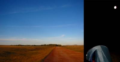
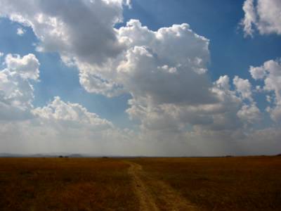
heavy thunderstorms last night, slowly passing, as if they had decided to stay for the night at bayanxile's pasture home too. in the morning, a misty walk to the bathroom, the usual hole in the ground in a separate shack. my room has a big window. dreary bayanxilemuchang and its supersized “enjoy the beautiful grassland and mongolian culture” sign next to the Sinopec gass station don’t make a convincing alternative to the road ahead though – who minds some drops of rain when both a mysterious section of the great wall and dalai nur, a freshwater lake, are on the menu of the day? maybe even migrating birds along the shores of the lake, or some wild beasts? or real yurts, with real nomads, finally? I wrap feet and tent in the plastic cover of the breakfast table – soon I’m biking away, on the other side of the big window.

rain gets worse - amazing how different the grasslands look without towering blue skies. but then, as gradually as the road climbs, the rain gets lighter, up to a point it stops to bother. it’s snowing! I can’t help laughing out loud - de verplanckskes were right! back in sunny beijing, they had warned me (in onvervalst ardoois) for september snow in mongolia…


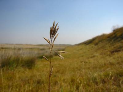
as long as I keep biking (and laughing) the cold is ok – hands and feet go into permafrost. it’s silent, almost cozy, in my grey bubble with fuzzy white dots. until an overwhelming buzz takes over from the humming of my tires… through the thick curtain appears the slender silhouette of a wind turbine, slowly making its turns… an equally undisturbed shepherd completes the surreal picture. back to the future. the shape of the earth mound in the distance seems regular enough to qualify as that forgotton part of the great wall. dalai nur is off limits.

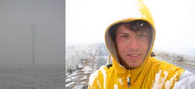


mud mound or wall of china?

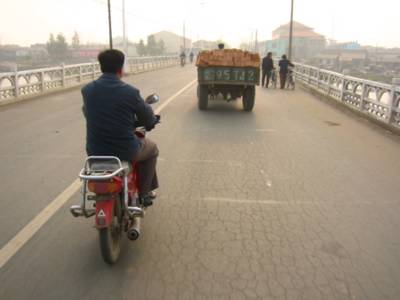
pretty worn out and slightly disoriented when I manage to stop a truck. the driver pulls over, climbs on his load of coal and hoists my bike all the way up. as if he picks up bikers in blizzards all the time. my frozen hands fail to take out extra ropes to secure the bike, but he assures me it’s going to be allright.
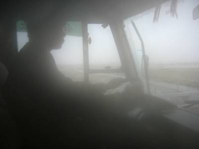


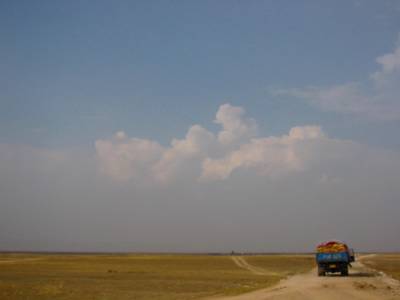
thawing hurts, but he has cigarettes and a warm coat, and I have bulk peanuts. another cozy bubble. after noticing my bike through the cabine’s rear window, stable on a bed of coal, I fall asleep. my generous friend brings me eighty kilometers further east, to keshiketengqi, a sizeable city with sizeable puddles, down in a valley surrounded by mountains.
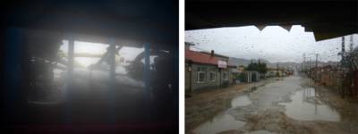

bike on coal through the rear window, and waking up in the next city


4 different sets of characters on MongolTV - cyrillic, latin, chinese, mongolian

hard to tell if here too rain turned to snow today… in any case, magic continues - at night, after winter gear shopping (shoes/gloves/socks for 15 bucks) skies are on fire, and lava creeps through the streets.
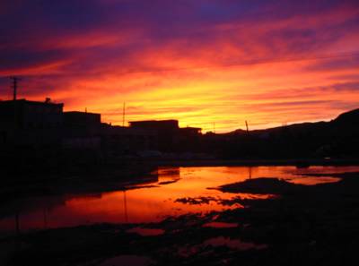


the real city of keshiketengqi feels very different from the pioneer outposts of the past week. walking around, I realize the truck drove me back to inhabited china, safely inside the wall. at the same time, chances to come across a real yurt from here are seriously shrinking - getting to know fellow nomads in inner mongolia turns out to tougher than expected… next time I’ll fix myself one of those packaged ‘stay a night in a yurt’ trips.
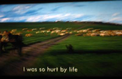


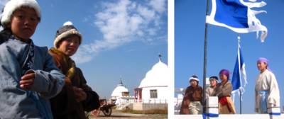
ironically, back in beijing, I will see a small independent movie called Heavenly Grassland [city boy grows up with mongolian nomad step(pe)parents in unspoilt yet harsh surroundings]. landscapes felt deja-vu, and indeed the closing credits show the movie was shot in the grasslands around keshiketengqi…

September 29, 2004

arteries of cultivation

desertification in xilingol league


September 28, 2004

my inner mongolia

sanggin dalai – balyinkulunjunmuchang – xilinhot - bayanxilemuchang


September 26, 2004

xanadu

zhangleanqi - sanggin dalai

"The greatest palace that ever was … The walls were covered with gold and silver and the Hall was so large that it could easily dine 6,000 people …The palace was made of cane supported by 200 silk cords, which could be taken to pieces and transported easily when the Emperor moved …”

and so on. even though marco polo tends to exaggerate in his reports – we’re not even sure if that cabrón ever made it to china – still xanadu, or shang-tu on this map, the palace of kublai khan where polo arrived in may 1275, seems to have made a serious impression on him.
according to the rough guide "virtually nothing of the site remains” – in any case not enough for directions more specific than “northwest of the modern city of duolun”… which means roughly northeast of the modern city of zhangleanqi (yes lanxie)! reasons enough to set out on a little side excursion today.


a new train line outside zhangleanqi

it was all just a little too perfect… no kanjis, but some directions from a shopkeeper, also shepherds pointing in the same direction. and after turning north, in the distance… a palace! a bright white one, with domes, dramatically approaching on the axis of the road. is this what marco polo saw seven centuries ago? would it have been restored since the rough guys passed here? turned into a marco polo amusement park? where are the busloads of chinese tourists?


palace ahead

once I pass through the gate and come to a halt, no time for those questions. soon I'm surrounded by the mongolian republican guard, and surrender immediately – this time my face definitely at least as astounded as the ones around me. there we stand for a while, silently gazing at each other, some of them casting jealous glances at my horse… a borat style crew member breaks the spell, confirming they are shooting a “moving” there.
after wandering around the set for a while, suddenly I remember what had brought me there. again from borat, I (hardly) understand these white domes serve as a “mongolian style” tourist village outside the movie making season. no remains, no greatest palace that ever was...

so I take off, kind of disappointed yet happy with the surprise, waved out by the whole circus. if you ever come across a boring mongolian dynasty movie with the guards missing or turning their heads collectively in the wrong direction…


but another surprise was waiting ahead. while bending north and trying to reconnect to the road, all of a sudden, a metal gate across the road (open), an abandoned ‘museum’, and a shack with remains of archeological activity: some books and drawings, even some clothes and a bed, the wind blowing through. no one around.
and then a little further down…
xanadu.

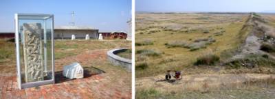
what I see are two huge rectangular mounds – grassy remains of the walls polo talks about – the outer one enclosing nothing in particular but the inner one, and the inner one enclosing some scattered stones. still no one around, calvino’s città invisibili blowing in the wind.
a great place, the greatest that ever was.


"le musée est a pàris" / the southeast corner of the outer mound


the rest of the day – powered by a xanadu energy boost – “bending north and trying to reconnect to the road” the sequel…


>01

>01 joe ‘midnight cowboy’ buck cruising on the grasslands
>02 hilly territory // here and there a sandy valley


>02


>03 >04

>03 road narrows to a double track, going up a recently reforested valley // some drops of rain along with doubts if there is a connection
>04 track fades and stops before the pass // slopes on all sides // shit // back to creepy zhangleanqi? // notice the tiny stupa on top of the ridge (mongolians share lamaism with the tibetans)


>05

>05 leaving bike behind for a short hike up to the stupa


>06

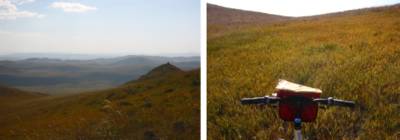
>06 stunning 360º views and strong winds on top (more sandy scars ahead apparently)
>07 also from on top, an idea on where to take the pass
>08 hoisting and pushing bike and household through rocky bush // inner mongolia hiking biking foliage trips


>07 >08

on the other side, I make a soft landing in a tree plantation and get picked up by two farmers on a motorbike. they look kind of bewildered (just like me wondering how the hell I got into their plantation) but later they ask if I had been praying at the stupa, laughing… I show them the kanjis for sanggin dalai (reconnection point) and they point west / how far? / showing 6 / 6km? / yes 6. it turns out to be 60… (the first in a series of decimal misunderstandings)


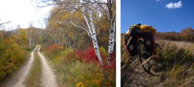
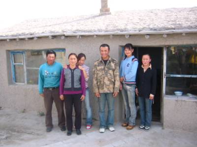
a blessing – instead of pulling into another dusty town’s cabbage room, tonight I sleep on a haystack of a beautiful family. father son and daughters are collecting hay and mom is herding back the cows as I pass their farm at sunset. they smile, take me in, yet hardly interrupt their daily lives (without electricity) for the stranger. what a relief. being ‘stuck’ in the middle of nowhere feels surprisingly relaxing and comfortable.


my hosts for tonight


candle light dinner

for dinner mom dishes up a thick and tasty noodle soup (with beef, ginger, and cilantro), mongolian milk tea, and fruit, to which I add a pasta quattro formaggi – not a stunning success, but recipe for intercultural fun, as I make them eat it the same way they relentlessly refill my cup. later, the girls take out an english textbook, with a small dictionary in the back, from english to chinese. so they have to run through the whole list for every english word they want to ask me, by pointing. but it works. under the light of one candle, we exchange words about their farm, my trip, the price of my camera, dairy products, a dollar bill. dad silently flips through all the pictures on my camera – he’s never been to beijing – and mom gets openly embarrased he's taking so long. in the end, they point at the heartbreaking combination of "back” and “again” and a question mark… imagine...


family portrait at dawn

September 25, 2004

kanjis of the day

guyuan - zhangleanqi


a buddy guiding me out of guyuan

behind a coffee in beijing I had already figured out my maps wouldn’t help me that much. thought I was well prepared though – from a specialized bookstore in tokyo I had bought a northern china road map and a slightly more detailed aviation map, supposedly the best one availabe. but comparing both maps to set out a tentative itinerary turned out to be a worrying affair: roads and even place names didn’t coincide. find the seven similarities…
outside of the coffee bar, different worries. apart from being inaccurate and too small for a bike trekking (my daily 100km corresponding with a pathetic 5cm), both maps depict place names in latin characters only, making them completely cryptical for the average chinese along the road. very few locals read latin characters, even less seem to have an idea what their region looks like from above. while I had no tools to decode the average road sign
speech didn’t help me a lot further either. mandarin is an intonational language, with four tones, (unlike japanese) very hard to transcribe, and impossible to pronounce… being misunderstood is annoying, but being mute while speaking is hopelessly frustrating. even when I tried twenty different pronounciations of the next town’s name, still not a single face out of the full screen collection gathered around me would show a sign of remote recognition. a recurrent nightmare… [jesus, what the hell could I possibly be trying to say, with a map in my hands and a bike under my ass?]


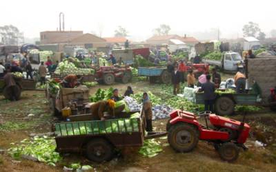
faces turn around, hands keep trading cabbage - a common sight at guyuan's saturday market


but in the end all works out fine, even for a mute traveler with blind maps. pretty quickly I learned to depend on the position of the sun and the shape of the land (the aviation map having topography lines), to change my definition of ‘working out fine’. and to find the kanjis of the day, the chinese characters corresponding with the town I wanted to reach.
one day one of the faces brought me to the local ‘middle school’, interrupted a class without apologizing and had the geography teacher study my map. I walked out of the school with kanjis for a couple of days…

lack of maps turns every day into a little pilgrimage. this one, the first day on the grasslands, in particular, since the town to reach goes under a couple of names, ranging from zhangleanqi (on the map) to something that sounds like ‘lanxie’…
I try “zhangleanqi?” while pointing in a certain direction / question mark faces / get off my bike, show them the kanjis / “aaaah, lanxie!” nodding heavily and showing me the way //// next fork, same story, zhangleanqi and lanxie interchanged /// etc


next fork


lunch in a hui village
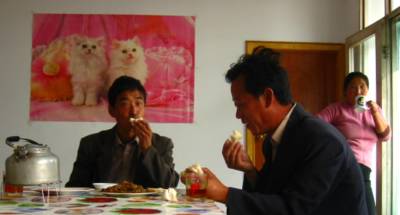
with other muslim minorities, the hui make up almost 10% of the chinese population. still I was surprised to find them so far east on the silk road... opposite to the cats, there's a poster of mekkah with a quote from the quran.
here, as in most 'restaurants' during the first week, I had a plate of jaouza, dumplings stuffed with mutton and scallions. a classic, safe, and easy to order. only later I found the kanjis for "house specialty" - a secret code to a way more exotic universe, dished up by proud chefs...


picture the disappointment when at the end of the day, zhangleanqi slash lanxie is just another unhospitable concrete settler’s camp. dust blasting through the town’s two oversized cartboard boulevards. brand new factories on the outskirts. feels like zhangleanqi has been dropped off by a couple of trucks just last week. at night, no one outside, loud laughter from behind dirty windows. the wild west.

this is inner mongolia, just like other ‘autonomous regions’ in china the forefront of state organized han chinese colonisation. until a couple of decades ago these grasslands – roughly beyond the great wall – were used as pastures by semi-nomadic mongolian shepherds, while intensive agriculture stopped at the end of hebei’s fertile valleys. today, the mongolians, of which the majority has been forced to settle down, are outnumbered by han chinese by nine to one. this might explain the disappointing geographical knowledge of the 'locals'. it definitely explains the sand storms in beijing…
towns like zhanleanqi will only get more depressing as I move on north, higher on the mongolian plateau, to colder, more fragile ecosystems.


notice the mongolian style dome on the new building... duck or decorated shed?

September 24, 2004

hebei northern province

beijing - shitai - chicheng - guyuan


biking out of beijing at dawn along chang’an jie, cutting tien’anmen gate, entrance gate to the forbidden city, from tien’anmen square, a little further on the right. in good company of humming fellow bikers – there’s enough space for all on china’s number one parade boulevard. I’ll be back.


new construction around the capital consists of pretty depressing stuff, low quality copy/paste with dorky ‘traditional’ roof details. built with the same level of detail as the average highway bridge, but advertized as the versailles of the east. very poor communities too, some gated, most lacking sidewalks and other facilities, all of them designed on cars – preferably volkswagen, “the car of the people”, the nation’s favorite (audi for party officials).


first sight of the great wall, and a crumbled section at huanhuacheng

surprisingly quickly though, only a couple of hours north of beijing, I found myself pedaling around in rural china: big trees lining fertile valleys, the one-size-fits-all brick houses, the village people, the smell of coal fires, donkeys, and the rest of the bucolic painting I would bike through over the next three days. no nature in hebei, every inch I saw of it is cultivated, every valley terraced.


whose motorcycles are these? - see the guys that are finishing the last character on the opposite hillside? it's theirs baby. the wonders of the chinese workforce - look at the picture to the right and notice the distance between the road (left) and the inscription...


chicheng middle school - the whole class sang "my heart will go on" for me...


meanwhile, on the countryside...

the great wall might never have been a waterproof protection system, at least it served as a road, a very steap one, in difficult terrain. seems like communist engineers built their roads on that tradition – hebei roads are good, well-maintained by lots of hands, but steap. before the end of the first day, I was suffering on a strenuous mountain pass. took me only a couple of switchback to discover why beijing (“northern capital”) and hebei (“northern province”) make up the northern edge of traditionally inhabited china...


looking back...


rural delight

on the mountain passes, time enough to get used to loneliness, to wish myself a buddy. in the valleys, the first alienating contacts with the chinese countrymen, more reasons to wish myself a buddy. but then, north of the northern province, well beyond the wall, suddenly the valley widens, mountains flatten out and gently roll onto the highlands. expanding horizons, no more worries, no more wishes.
a pasta marco polo with the first grasslands in sight. at the edge of the pastures of the mongols, looking forward to meet some fellow nomads...